Integration
Integration
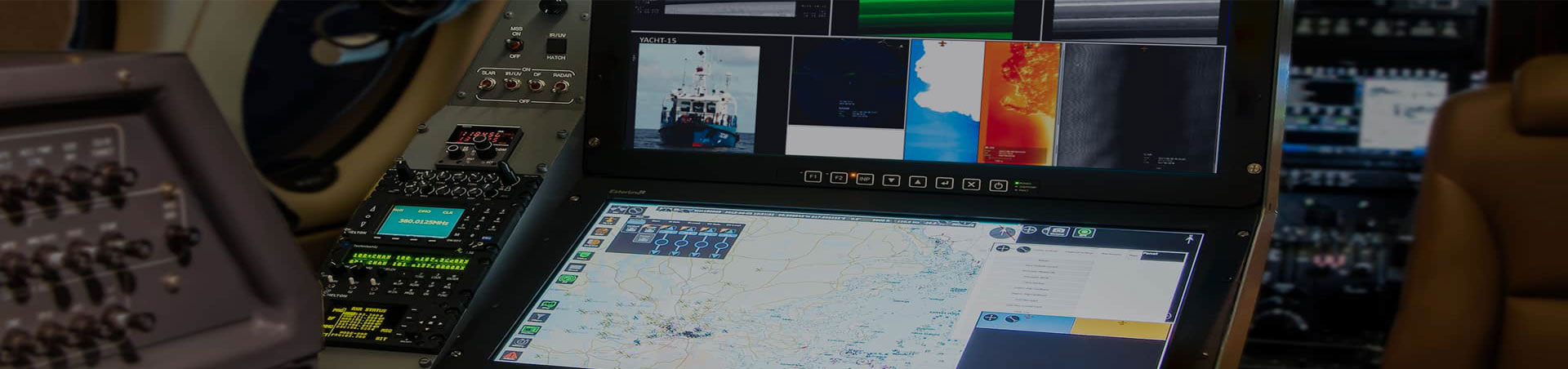
The ST Airborne Maritime Surveillance System comprises a field proven suite of sensors complete with data processing and mission management software to support the operator in performing the surveillance task. In order to facilitate user friendliness and operational efficiency, integration is a cornerstone of our system design.
The sensors and mission management software form a unity from the operator’s point of view. Sensor data, maps and reports are presented in pre-assigned windows. All mission data is recorded digitally. This allows the operator to simultaneously operate a number of sensors, keep an eye on the overall situation and at the same time access stored data, communicate and exchange relevant information in real time with co-operating units and prepare the mission report.
All sensor data, images, targets, etc. are annotated using navigation data from a single source, so that each piece of information becomes an integrated part of a Geographic Information System (GIS) on board the aircraft.
The mission report, target data base, digital charts, and other key information are all integrated into the user interface. This ensures that the system operator has access to the relevant information in all situations.
The MSS 6000/7000 equipped aircraft is an integrated part of your surveillance organisation. It has the capability to exchange information in real time with Headquarters and on-site Mission Management Centres, and thus act as both an information source and a resource in support of the operation.
